Wild Boar Fell from Ravenstonedale - Yorkshire Dales walk
We thought it would be nice to share more details of some of the circular walks that form part of our trips, for people who live in the area or are interested in doing these walks individually, rather than as part of a longer walking holiday.
We are starting with the route up Wild Boar Fell from Ravenstonedale, which is part of our new ‘Food and Fells of the Cumbrian Dales’ walking holiday.
NB: This is a description of what the route is like for information not a specific guide to the route and should not be used as your walk notes if you want to attempt this route. Always have a map and compass and know how to use them.
A perfect village and classic Dales farmland
Despite being in the Yorkshire Dales National Park, this route is entirely in Cumbria, within the area of the park that was added as part of the 2016 extension. It is a worthy addition and certainly rivals the Yorkshire section for scenery and interest, and tends to have far fewer people than the more well-known areas of the park.
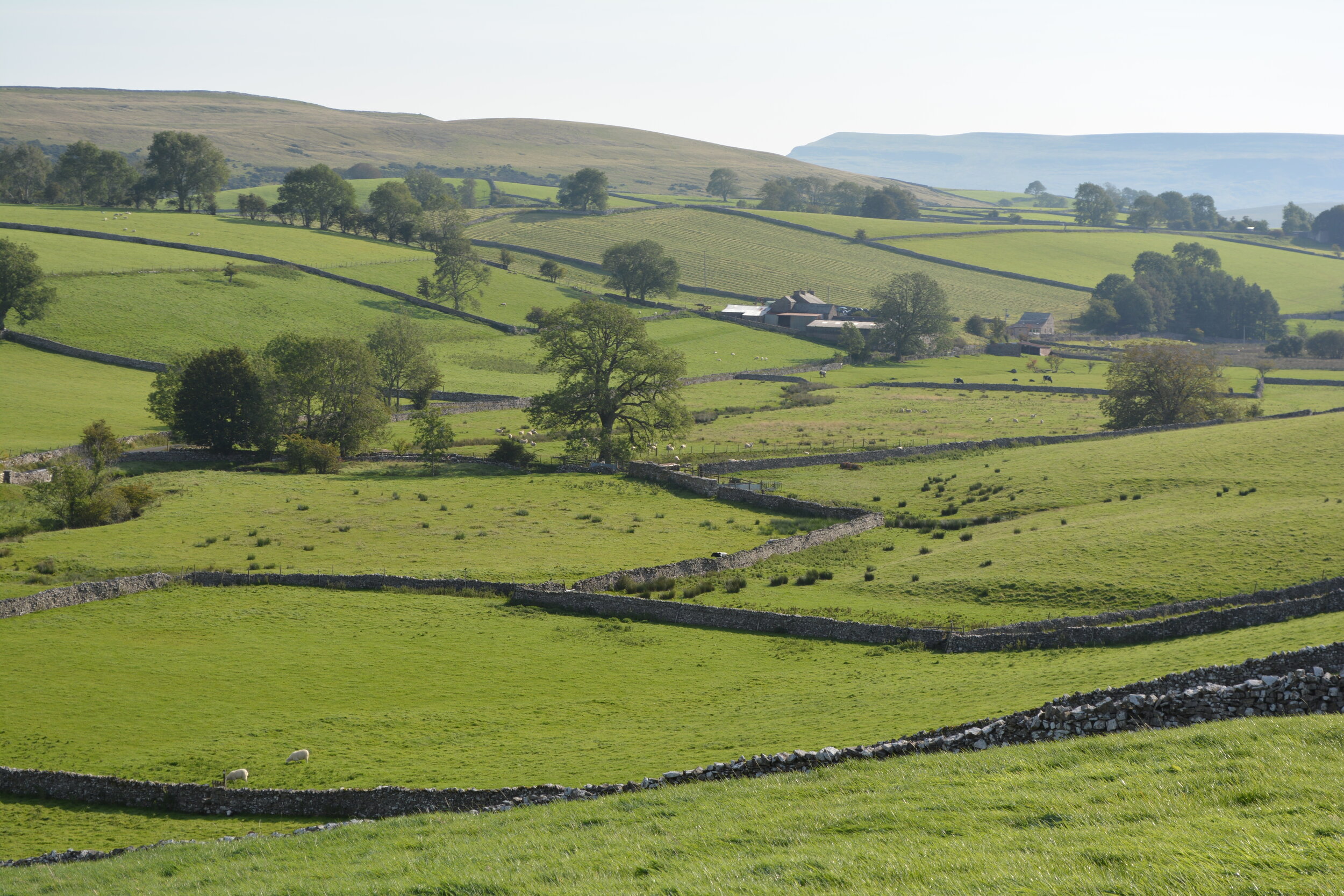
The route starts in Ravenstonedale – a lovely little village a few miles outside Kirkby Stephen that, if located in the southern Dales, would certainly be a ‘honey-pot’ – it is surrounded by excellent walking country, has two fantastic pubs, a small shop and gallery, a little ‘honesty box’ golf course and a tennis court (clubs and rackets can be borrowed from the pubs!).
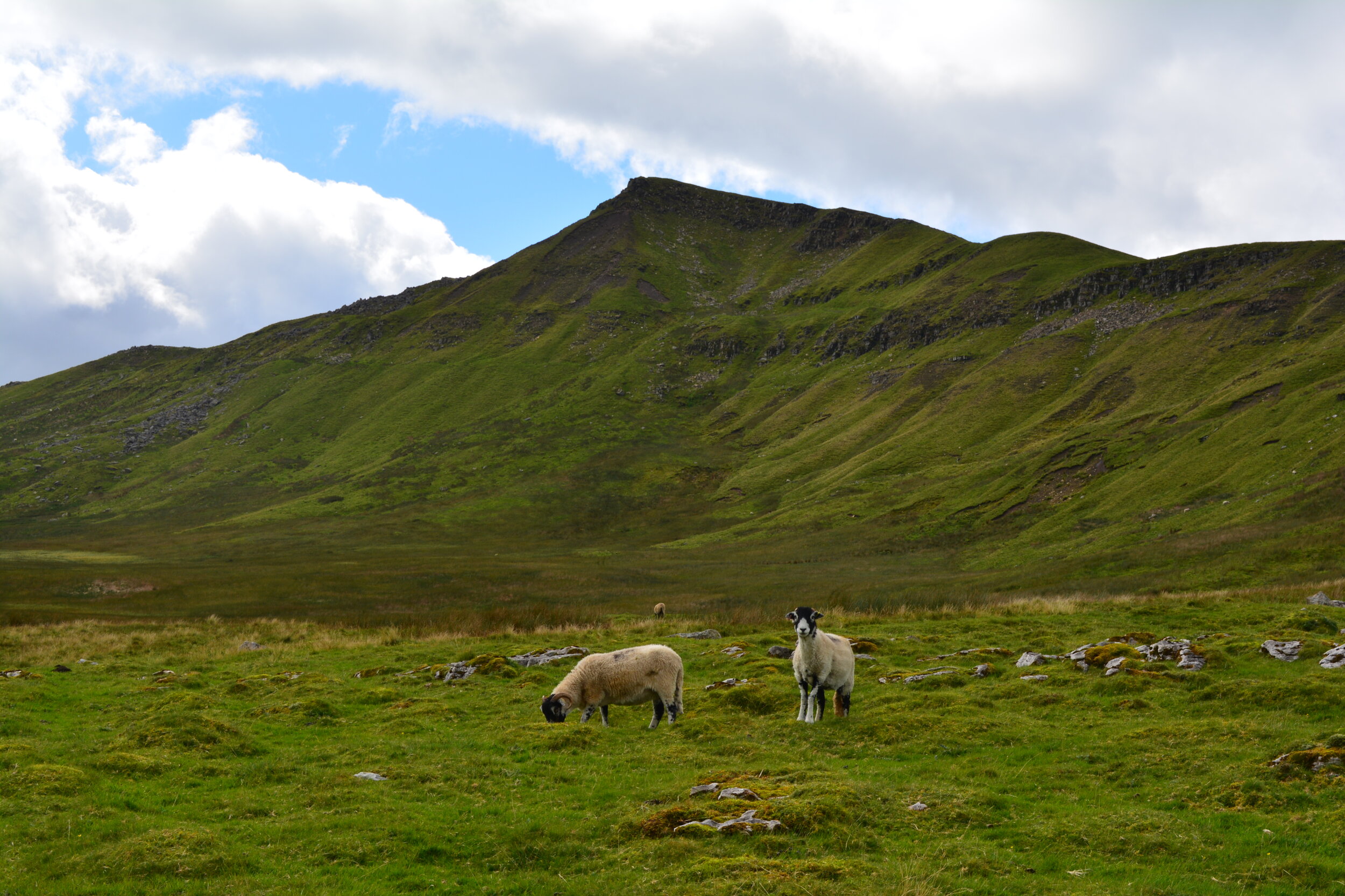
The walk sets out across farmland and great views across fields and dry stone walls open up almost immediately. Despite its location in Cumbria, this is classic Yorkshire Dales scenery, but the fact you are in Cumbria is soon evident as you get views to the rounded summits of the Howgill Fells to the right and the brooding shape of Wild Boar Fell rises ahead. You can now see the summit you are heading for until you reach it!
Fabulous views as far as the Lake District
After gaining a little height through the fields, you join a broad bridleway, which is part of the ‘Pennine Bridleway’ National Trail. It soon takes you out onto open moorland and this well-maintained track takes you all the way to the col between Wild Boar Fell and Little Fell, crossing several pretty becks as you go. Stunning views back to Ravenstonedale, over the Howgill Fells and, as you gain more height, to the Lake District, open up behind you, giving plenty of excuses for a breather.
On reaching the col you meet a gate in the dry stone wall along the ridge and, once through it, you take a clear path continuing uphill to the summit plateau of Wild Boar Fell.

Explore the fascinating summit plateau
At 708m, Wild Boar is the 5th highest peak in the Yorkshire Dales National Park. It is reported to be the place where the last wild boar in England was shot in the 15th century. It is interesting for its geology – sandstone, shale, limestone and millstone grit are all present – as well as its history. There are of course the views to enjoy as well - the view down into the Mallerstang Valley is stunning, backed by Abbotside Common and the high point of Great Shunner Fell to the east. The southern view is dominated by the ‘Yorkshire Three Peaks’, with the distinctive profile of Ingleborough clearly visible (and you may even be able to see as far as Morecombe Bay). The Howgills are prominent to the west, with the Lakeland hills behind. The wide expanse of the Eden Valley is laid out to the north, backed by the North Pennines.
You can spend some time exploring this large summit plateau - you arrive at a point called ‘The Nab’, the site of an ancient burial mound marked by a small stone cairn. This is a fantastic spot to catch your breath and admire the far-reaching views.
You head south-west to reach the large summit shelter and trig point at the true summit of the fell, which you should be able to see from the Nab. From the summit shelter, you can take a short detour by following a narrower path on its far side that drops downhill to a ridge, from where you can reach ‘Sand Tarn’. The sand from the shores of the tarn, which is made from millstone grit, was reputedly used by local people to sharpen knives. This can be a great spot for a dip on a hot day if you enjoy wild swimming!

From the summit shelter, another track takes you south-east, back towards the ridge at ‘Yoadcomb Scar’. It crosses boggy ground, aiming for another stone shelter and, as you can soon see, a row of impressive stone cairns or ‘standards’ (like those found at Nine Standards Rigg). The best views of the Three Peaks are gained from here.
‘Off-road’ descent across the moor
You can return to the Nab along the escarpment then retrace your steps to the col. The first section of the return leg is over access land, mostly following visible tracks but not designated public footpaths. The track heads due north to reach the summit of ‘Little Fell’ marked by a small cairn and its own set of small standards. The route then drops down off the fell (with an option to detour to visit the atmospheric ruins of tiny Pendragon Castle), covering some wet ground and continuing to head north to emerge on little ‘Tommy Road’, an open road over the fell that links the Mallerstang Valley to Ravenstonedale.
Quiet country lanes and time for a pint!
The last leg of the route back to Ravenstonedale is all along the road, but these are open, unenclosed roads and quiet country lanes, all with wonderful views back to Wild Boar and over the Howgill Fells. They travel through farmland and eventually bring you out on the little stone bridge back into the village of Ravenstonedale, where you can relax with a drink in one of the excellent pubs!
If you are interested in our ‘Food and Fells of the Cumbrian Dales’ trip or any of our other walking holidays, please do get in touch.